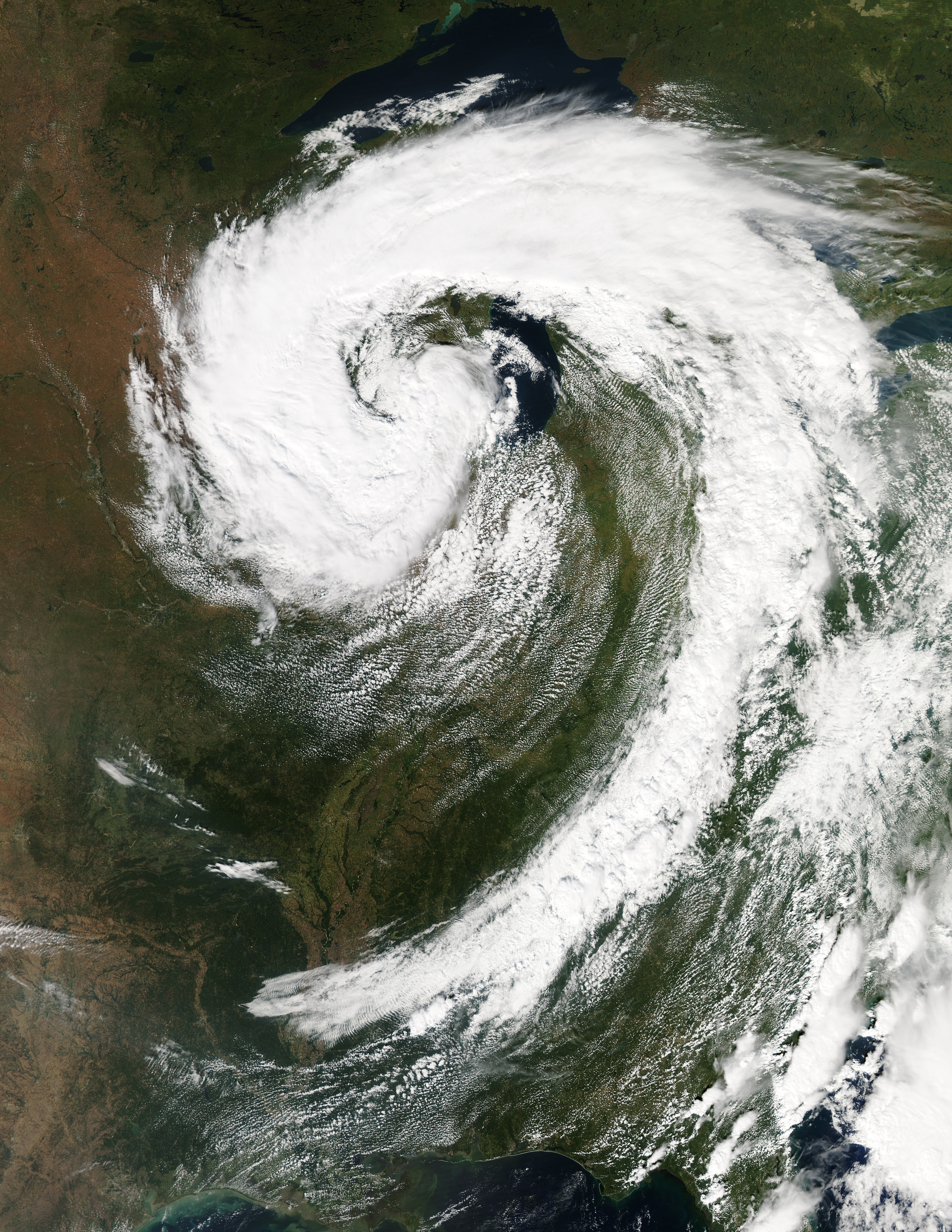
In addition to some images on the ground there will also be so images in space as well, as satellite imagery can capture some remarkable weather events that are happening on Earth from the area of space. For this case, we are looking at a mid-latitude cyclone that is moving over the Great Lakes of in the United States in North America. Also, just to get this out of the way now and so that there is no confusion, mid-latitude cyclones are not a hurricanes. That will be a topic to talk about in the next image.
Mid-latitude cyclones drive most of the stormy weather in the continental United States. Development of these cyclones often involves a warm front from the south meeting a cold front from the north. In the Northern Hemisphere, cyclones move in a counterclockwise direction. (In the Southern Hemisphere, cyclones are clockwise.) The bands of cold and warm air wrap around a center of low pressure, and air rising near the center spurs the development clouds and precipitation.
The image displayed above is a mid-latitude cyclone in the Midwestern United States that was taken by the Moderate Resolution Imaging Spectroradiometer (MODIS) on NASA’s Aqua satellite at 3:05 p.m. Eastern Daylight Time on September 26, 2011. The center of the storm appeared immediately west of Lake Michigan. The Capital Weather Gang at The Washington Post reported that the storm was at its most mature stage on September 26. Sporting a comma shape spanning hundreds of kilometers, the storm was comprised of a combination of warm, moist air (clouds) and cold, dry air (cloud-free areas).
Sources used:
https://earthobservatory.nasa.gov/images/52297/mid-latitude-cyclone-over-the-united-states